Discover the Advanced Features of Fishing Maps
Fishing Maps is an essential addition to your game fishing kit, enhancing your experience and community knowledge with a suite of science-based tools. Leveraging the power of oceanographic expertise, satellite data, and advanced modeling, Fishing Maps provides fishers with comprehensive insights into ocean temperature, productivity, currents, and much more.
User-Friendly, Offline Capable, and Forward-Looking Features
Fishing Maps is Easy to Use
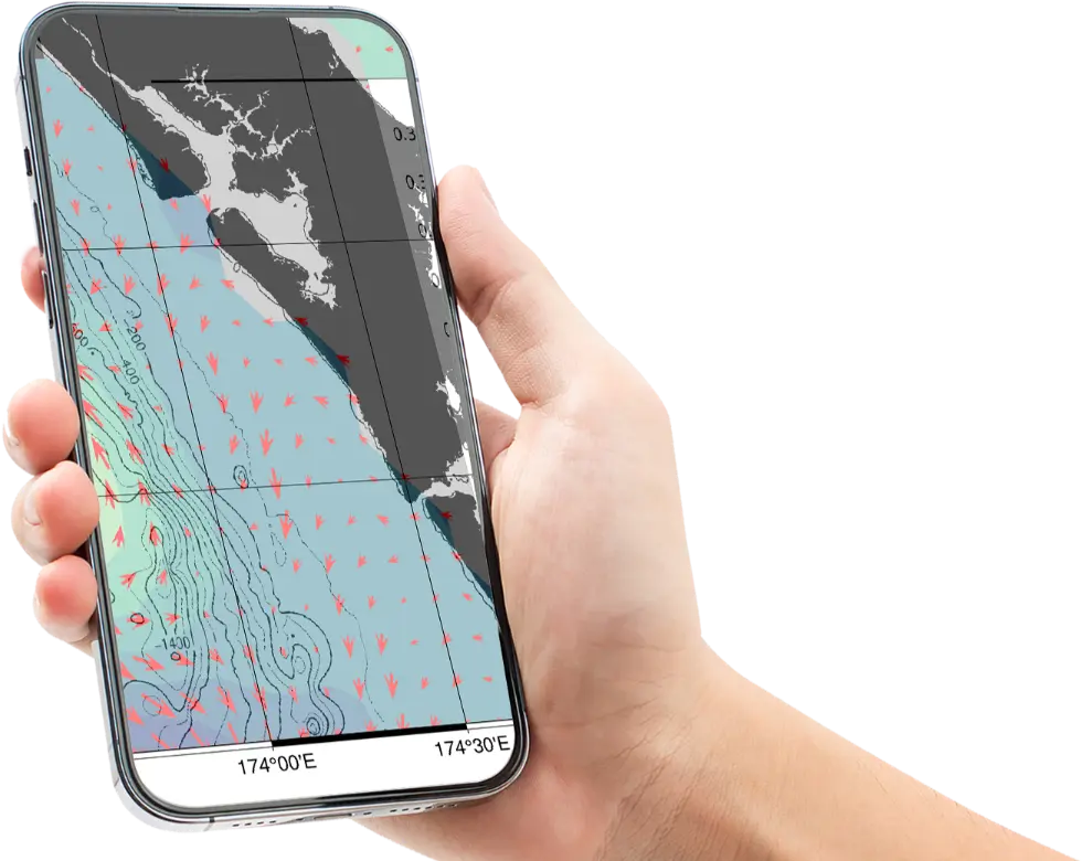
Watch the video tutorials to guide you every step of the way. Access your maps effortlessly by clicking an email link—no password required. Find your region quickly with an easy search, avoiding long lists. Download the maps you need directly to your device and check for SST updates every 3 hours.
Fishing Maps has Offline Navigation
Fishing Maps is not just maps, it’s Geolocated Maps for Offline Navigation. View the most recent 4 days of maps on your computer at night, download updated maps for your trip in the morning, and use offline navigation on your phone or tablet to get to a front or feature of interest.
SST, chlorophyll, current, and bathymetry maps import seamlessly into the free Avenza Maps app. Locate your position, measure distances, drop markers, add photos or notes to markers, and create layers with markup that will show on all the maps.
Fishing Maps is Forward Looking
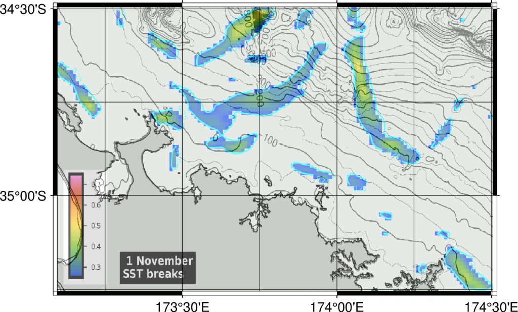
Fishing Maps is not a static product. Maps are regularly updated and improved, building on Sam McClatchie’s programming and analysis capabilities. From Front Detection to New Satellite Products to AI Detection of Fishing Hotspots, Fishing Maps will continually bring improvements to deliver the highest quality, most useful maps available.
We Specialize in the Areas of the World We Know Best
By focusing on New Zealand and California/Baja, where Sam McClatchie worked as an oceanographer for two decades, Fishing Maps offers you unparalleled depth of knowledge applied to the interpretation of the maps.
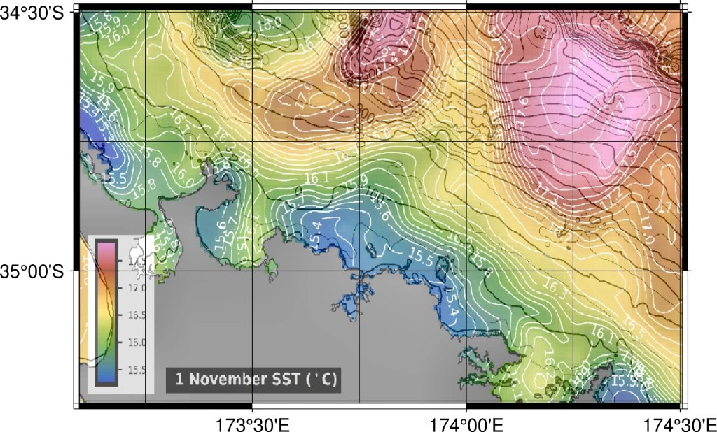
Cloud-Free SST
Experience precise sea surface temperature maps without cloud interference, ensuring accurate and reliable data for fishing.
3-Hour SST
Updated sea surface temperature maps every three hours, providing you with the most current information for your fishing trips.
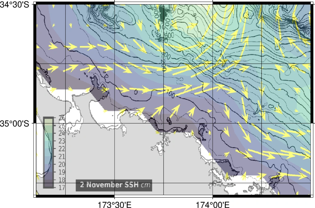
Ocean Currents
Visualize real-time ocean currents to understand water movement and predict fish behavior, enhancing your fishing strategy.
Chlorophyll
Identify nutrient-rich waters with chlorophyll maps, helping you locate areas where fish are likely to gather and thrive.
Bathymetry
Use detailed bathymetric maps to understand underwater topography and find prime fishing hotspots with ease.
Fish TempRange
Discover optimal temperature ranges for different fish species to improve your catch rates and plan more successful fishing trips.
Testimonials From Our Anglers
Your maps were spot on.
Nick Sheehan
Sam is an incredibly knowledgeable and experienced oceanographer. The product he produces is far more technically advanced than alternatives simply due to the effort Sam puts into his product as a result of his years of studying the ocean and the creatures that inhabit it. His knowledge is unmatched in the fishing maps industry.
Che Kranenburg